Close this alert
Caribbean Map (National Geographic Destination Map)
Current price:
$14.95
Publication Date: January 1st, 2023
Publisher:
National Geographic Maps
ISBN:
9781597754538
Pages:
2
Description
- Waterproof - Tear-Resistant - Travel Map
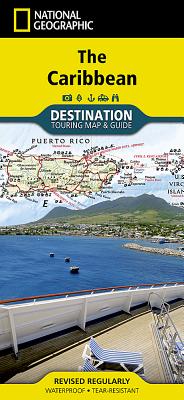
National Geographic's Caribbean Destination Map strikes the perfect balance between map and guidebook and is ideal for a wide range of travelers. The map includes a detailed road network and important travel information including National Parks and protected areas, airports, cruise ports, beaches, historic sites and ruins, and sites for recreation activities including diving, surfing, sailing, and golfing.
The front side of the Caribbean DestinationMap details the eastern Caribbean and includes beautiful photographs and helpful information on each of the island destinations. The Dominican Republic, Haiti, Puerto Rico, Trinidad and Tobago, Virgin Islands, and the islands of the Lesser Antilles are represented. Also included is important cruising information, inset maps of Charlotte Amalie, U.S. Virgin Islands and Old San Juan, Puerto Rico, and the locations of National Parks. The map also covers the pristine coast of Venezuela.
The reverse side of the print map details the western Caribbean, including the Bahamas, Cayman Islands, Cuba, south Florida, Jamaica, and the northern tip of Mexico's Yucatan peninsula. The map features beautiful photographs and information on each location, travel tips, weather information, National Park locations, and a locator map of major embarkation points for Caribbean cruises from the mainland United States. Inset maps for Nassau, Bahamas; George Town, Cayman Islands; Old Havana, Cuba are included.
Every Destination Map is printed on durable synthetic paper, making them waterproof, tear-resistant and tough -- capable of withstanding the rigors of any kind of travel.
Map Scale = 1:2,000,000Sheet Size = 37.75" x 25.5"Folded Size = 4.25" x 9.25"
Other Books in Series
Alaska's Inside Passage Map (National Geographic Destination Map)
Folded
Canadian Rockies Map (National Geographic Destination Map)
Folded
Four Corners Map [Trail of the Ancients] (National Geographic Destination Map)
Folded
National Parks & National Forest of the Us [Map Pack Bundle] (National Geographic Destination Map)
Folded
National Parks of the United States Map (National Geographic Destination Map)
Folded
Blue Ridge Parkway Map (National Geographic Destination Map)
Folded
New York's Finger Lakes Map (National Geographic Destination Map)
Folded
Pocono Mountains Map (National Geographic Destination Map)
Folded
Sierra Nevada Map (National Geographic Destination Map)
Folded
Wisconsin's Door Peninsula Map (National Geographic Destination Map)
Folded
Central Cascades Map (National Geographic Destination Map)
Folded
Texas Hill Country Map (National Geographic Destination Map)
Folded
National Wilderness Areas of the United States Map (National Geographic Destination Map)
Folded
National Forests and Grasslands of the United States Map (National Geographic Destination Map)
Folded