Close this alert
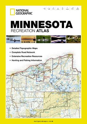
Minnesota Recreation Atlas (National Geographic Recreation Atlas)
Current price:
$24.95
Publication Date: May 31st, 2012
Publisher:
National Geographic Maps
ISBN:
9781597755207
Pages:
144
Description
National Geographic's Minnesota Recreation Atlas is the ideal resource for any recreation activity from hunting and fishing to camping, golfing, hiking, and more. This durable, easy-to-use atlas includes up-to-date topographic maps, a comprehensive road network, informative recreation guides, and a detailed index. All road types are clearly identified, making each atlas a useful planning tool for motorcycle and off-road adventures. Maps include bold boundaries for parks and federal lands, and clearly labeled lakes, rivers, and streams. On each map page you will find a convenient map legend, easy-to-read page numbers, a latitude and longitude grid for use with GPS, and fact-checked points-of-interest. Also included are cross-referenced charts of fishing areas with species information, game management units, campgrounds and attractions charts, state park maps and facilities, hiking, golfing, skiing and paddling destinations, climate information, and more.
- Detailed topographic maps with shaded relief for the entire state. Map scale is 1:175,000
- Each labeled feature is up-to-date and verified by satellite image
- Comprehensive, easy-to-read road network
- Boundaries for parks and federal lands
- Clearly-labeled lakes, rivers and streams
- Durable laminated cover
- Size 11"x15"
- Robust travel and recreation information
- Cross-referenced chart of fishing areas with species information
- Game management units
- Campgrounds and attraction charts
- State Parks maps and facilities
- Hiking, golfing, skiing and paddling destinations
- Climate informationMap Scale = 1:175,000Folded Size = 10.75 x 15.5
Other Books in Series
National Geographic Road Atlas 2024: Adventure Edition [United States, Canada, Mexico] (National Geographic Recreation Atlas)
Spiral
National Geographic Road Atlas 2024: Scenic Drives Edition [United States, Canada, Mexico] (National Geographic Recreation Atlas)
Paperback
Georgia Recreation Atlas (National Geographic Recreation Atlas)
Paperback
Pennsylvania Recreation Atlas (National Geographic Recreation Atlas)
Paperback
New York Recreation Atlas (National Geographic Recreation Atlas)
Paperback
Alabama Recreation Atlas (National Geographic Recreation Atlas)
Paperback